The weather is about to get frightful. Here is the latest information about the upcoming snow, as of 7:00 AM Sunday, February 7.
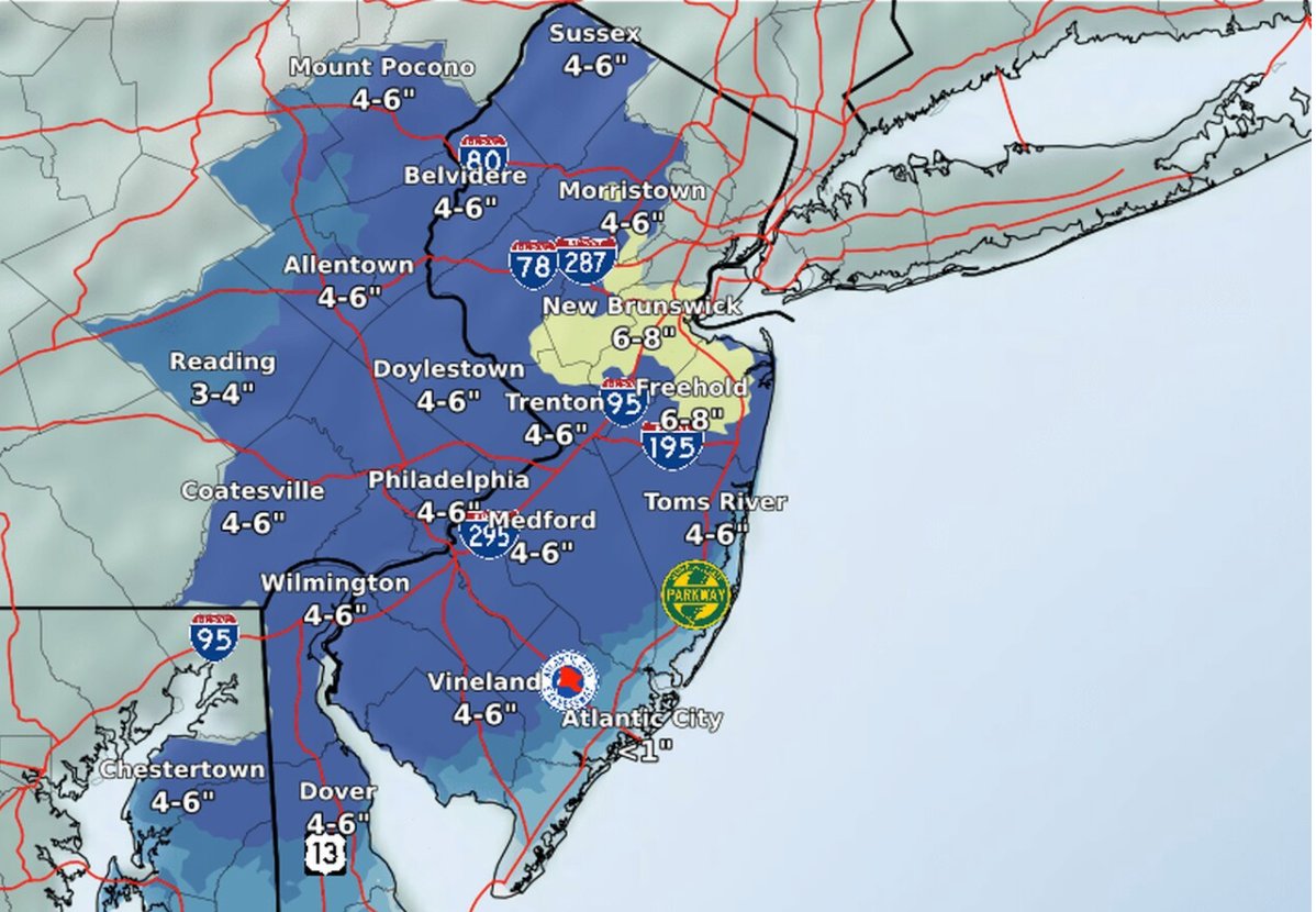
Overall, there will be 3 - 8 inches of snow depending on where you live, with Central NJ and coastal areas hit the hardest.
From the National Weather Service:
- Heavy snow expected. Total snow accumulations of 4 to 8 inches
- WHERE...Portions of central, northern, northwest and southern New Jersey, southeast Pennsylvania, northeast Maryland and northern Delaware.
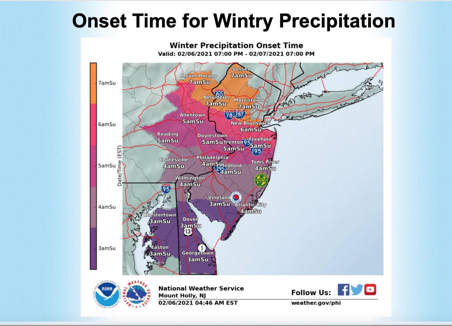
- WHEN...From 4 a.m. to 7 p.m. on Sunday.
- IMPACTS...Travel could be very difficult particularly late Sunday morning and early Sunday afternoon.
- ADDITIONAL DETAILS... A heavy band of snowfall will overspread the area Sunday morning, with snow continuing into Sunday afternoon.
- Snowfall rates of 2 inches per hour will be possible within this heavy band, and isolated snowfall totals in excess of 8 inches will be possible.
- Winds near gale force are possible on the Atlantic coastal waters adjacent to Delaware, the Delaware Bay, and southern New Jersey on Sunday.
- Significant coastal flooding is not expected with this system.